Engineering • Surveying • Planning
Building Communities with Quality, Precision, & Trust
Whether you’re a homeowner needing a property survey, a developer working on a complex project, or a municipality planning for the future, we bring the same commitment to excellence and client-first approach to every job.
years in Business
Most Experienced Firm in the Wood River Valley
A Local Legacy of Lasting Impact
In 2023, Galena Engineering and Benchmark Associates merged to combine over ten decades in business and a shared passion for thoughtful land development in the Wood River Valley and beyond. Today, we offer a full suite of services, from detailed land surveying and initial site studies to entitlement strategies and complex civil site design. Our collective knowledge, established relationships, and focus on practical, sustainable solutions allow us to guide projects seamlessly from concept to completion. With a legacy of trust and proven quality, we understand that every project represents important goals and investments for our residential, commercial, and public-sector clients.
- Client-First Approach
- Precise & Accurate
- Responsive & Timely
- Expert Guidance
- Full-Service in House
- Committed to Quality
- Established Local Network
- Technology Driven
All the expertise you need, in one place.
Multi-disciplinary Team Delivering Comprehensive Solutions
From initial site studies to final construction documents, we help clients navigate every step of the development process with clarity and confidence.
Engineering
Site development, water and wastewater design, roadway design, grading and drainage, storm water management, erosion control plans, construction inspections, floodplain compliance, and stream restoration.
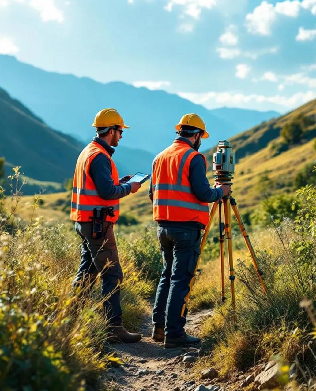
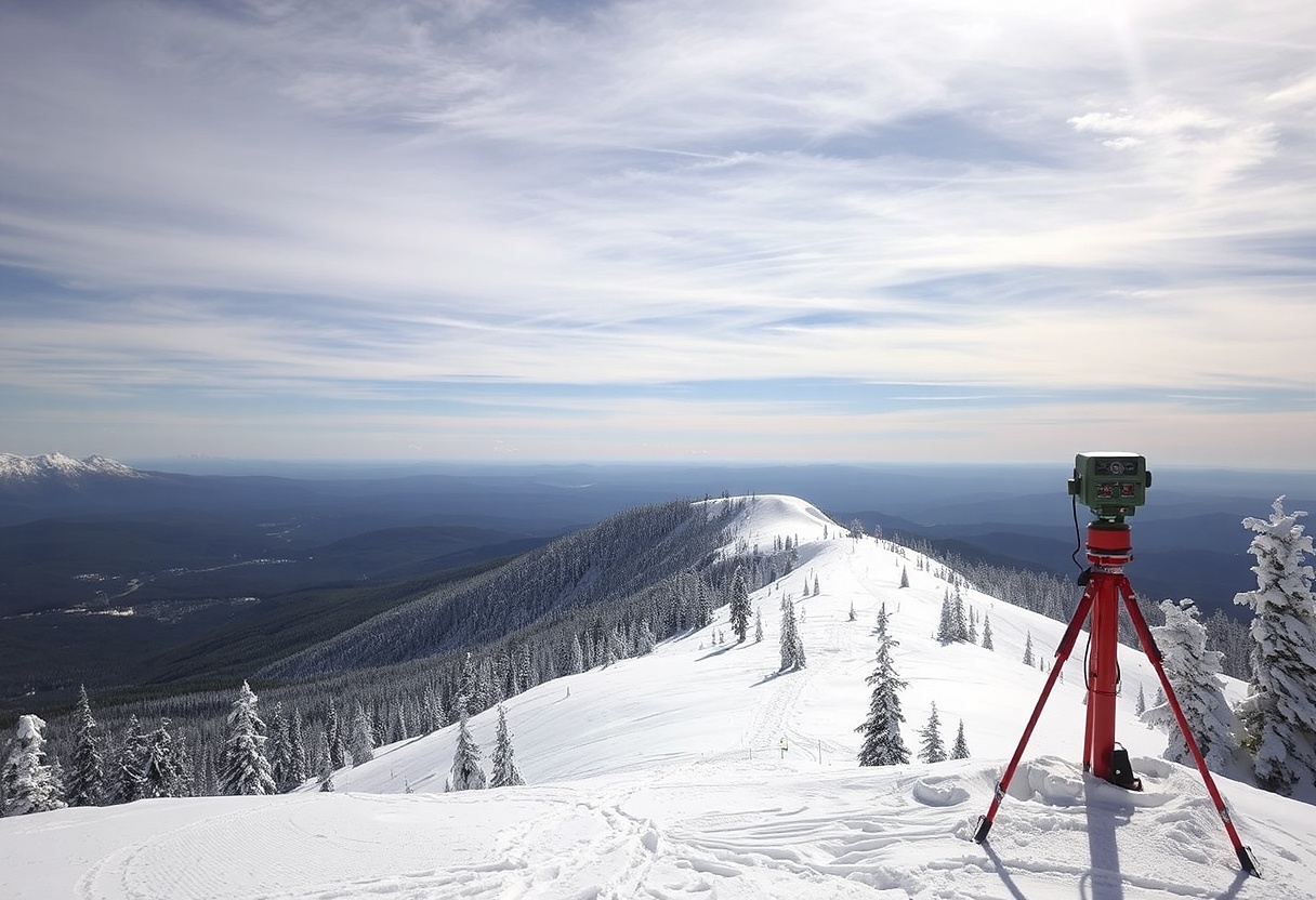
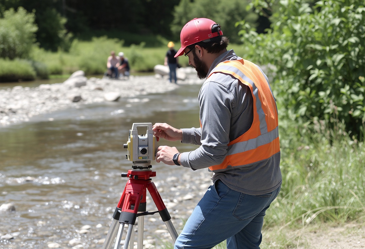
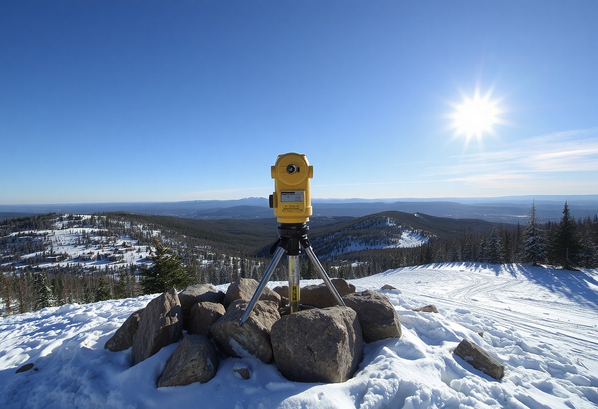
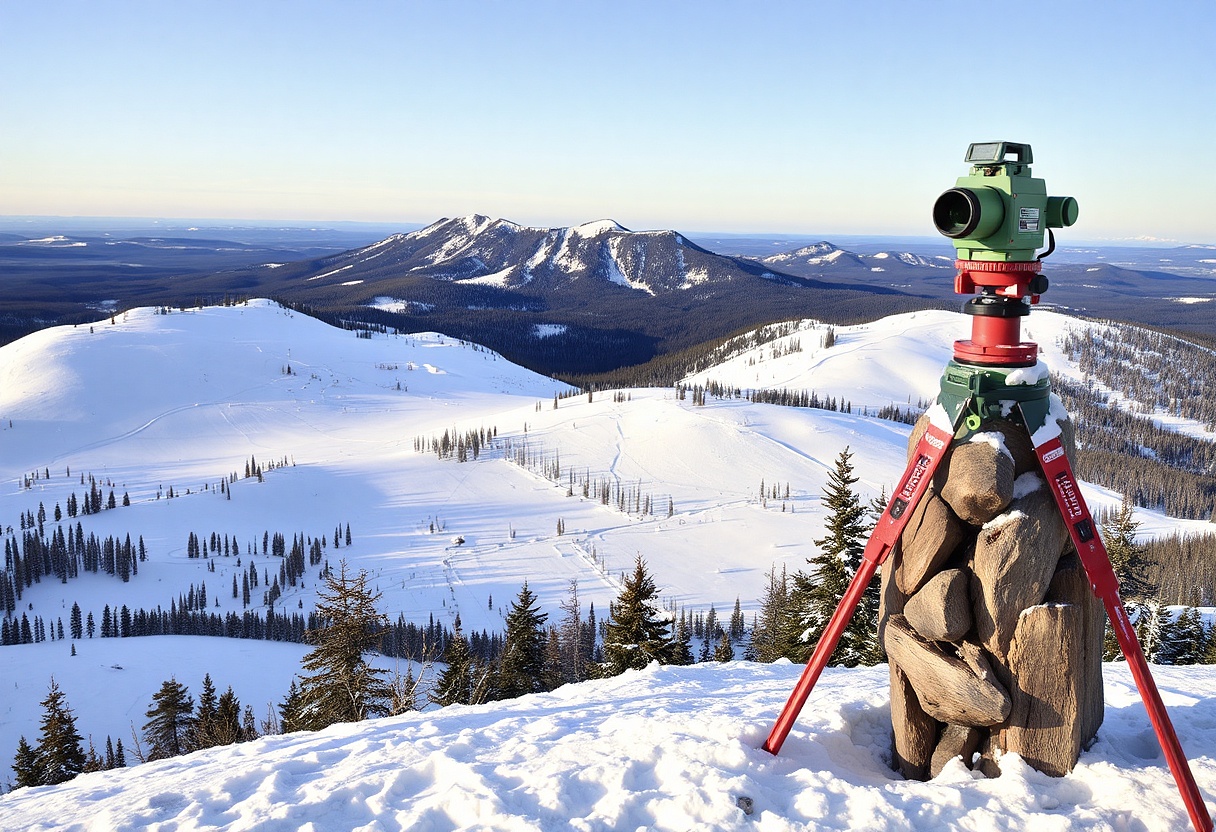
Surveying
Commercial, industrial, and residential surveying: boundary, topographic, ALTA, platting, 3D Scanning, Photogrammetry, and construction staking.
Why People Love Working with Us
"The team at Galena-Benchmark has been our one-stop shop for civil, surveying, and project planning needs for nearly a decade, and play a critical role in getting most of our projects off the ground. You can always count on the experts there for creative solutions and a job well-done throughout the building process!"
Conrad Brothers Construction
"As a Project Manager, I have had the opportunity to work with Galena-Benchmark on many projects over the past 20 years. From project design and surveying to final certifications, Galena-Benchmark has always provided excellent service and adapted to owner-directed changes in a timely manner, allowing for a smooth construction process."
Peak Venture Group
“Galena-Benchmark is an integral part of our initial site set-up and project execution. We appreciate their commitment to professionalism, ability to meet project schedules, and availability when an issue may arise. It’s a dedicated team of professionals that we enjoy collaborating with.”
Get Your Land Project Started Right
Accurate data is the foundation of every successful project. Partner with a team you can trust for precise, efficient, and expert land surveying services.
All the expertise you need, in one place.
Setting the Benchmark: Projects That Reflect Precision and Quality
Discover how our Engineering and Surveying have supported successful planning, development, and construction across various land projects.
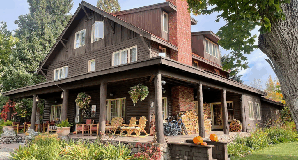
Ellsworth Inn
Lorem ipsum dolor sit amet, consectetur adipiscing elit, sed do eiusmod tempor incididunt ut labore et dolore magna aliqua. Ut enim ad minim veniam, quis nostrud exercitation ullamco laboris nisi ut aliquip ex ea commodo consequat.
Featured Service
Land surveying
Our land surveying services deliver accurate, precise data to support land development, engineering and architectural design, property transactions, and regulatory compliance. We provide boundary, topographic, ALTA (American Land Title Association), platting, 3D scanning, photogrammetry, and construction staking, each carefully executed with the latest geospatial technology. From establishing property boundaries and documenting existing conditions to verifying constructed improvements and supporting floodplain analysis, our surveys reduce risk and support sound decision-making.
- Boundary Surveys
- Topographic Surveys
- ALTA Surveys
- Platting
- Legal Descriptions
- 3D Scanning
- Photogrammerty
- Construction Staking
- As-built surveys
- Certifications
Projects Completed
Clients Served
Team Members Ready
Straightforward. Reliable. Built for Results.
Start with Accurate Data. Build with Confidence
We provide precise engineering, surveying, and planning insights that drive smart, successful development.
Let's Work Together
Request an estimate from Galena-Benchmark
Frequently Asked Questions
Got Questions? We’ve Got Answers
What types of land surveying services do you offer?
We provide a wide range of services including boundary and property surveys, topographic mapping, construction staking, land subdivision, as-built surveys, and GNSS/GPS-based data collection. Our services are tailored to meet the needs of developers, engineers, architects, and property owners.
How long does a land survey usually take?
The time required depends on the size and complexity of the property. A simple residential boundary survey can take 1–3 days, while larger or more technical surveys may take a week or more. We always strive to deliver accurate results within a reasonable timeframe.
Why is a land survey important before starting a construction project?
A land survey ensures that property boundaries are clearly defined and helps prevent legal disputes or costly construction errors. It provides accurate data for site planning, design, and regulatory compliance, ensuring your project begins on solid ground.
What equipment and technology do you use?
We use modern GNSS (Global Navigation Satellite System) receivers, total stations, drones for aerial mapping, and advanced CAD/GIS software to deliver precise and reliable surveying results. Our team stays up to date with the latest surveying innovations.
Do I need a survey if my land was surveyed in the past?
Yes, especially if the previous survey is outdated or if there have been changes to the property (e.g., new construction, land division). Local authorities or lenders may also require an updated survey for permitting, development, or legal purposes.
Project Manager
Lee Gilman Builders